[an error occurred while processing this directive]

FGMap - FlightGear online map


See the map in action!

more screenshots
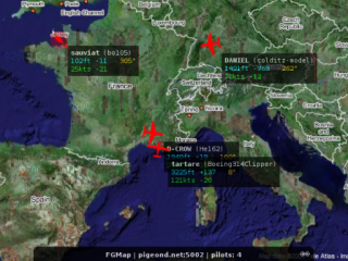
FGMap is a web application written in JavaScript, using Google Maps (GMap) API. It's a real time flight tracking map that shows where FlightGear pilots are flying online on the FlightGear Multiplayer Server.

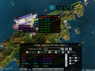
It also has navaids lookup that can be used as a navigational map, possibly for any flight simulator. So you can search for an airport and other radio navigation aids such as VOR and NDB.
How it works

At the moment it is pretty simple. The FlightGear server listens on a port for TCP connections, known as the "admin" port. When there's an incoming connection it answers in plain text who's online and their data, including locations and aircraft being used. FGMap uses AJAX to poll the server via a CGI, which translate the server admin port output into XML, and then presented onto the map.

In short:

Browser/JavaScript/AJAX <---> HTTP server/CGI <---> FlightGear server

This will definitely change in the future, to provide more information on the pilots and the environment.

As for the navaids, they are imported into a database (running PostgreSQL) from FlightGear's data. The map talks to it using AJAX via a CGI which does queries on the database and returns the result in XML.

Status

Monday, 03-Jun-2013 15:35:02 AEST

FGMap's code, together with its issue tracker, can now be found on GitHub.

Lots of updates and fixes. FGMap is now fairly well tested under Firefox, Mozilla, Opera, Konqueror, as well as the out of fashion IE.

METAR lookup is up. You can find it in the airport info box.

ILS info is updated. Airway is there. Use it. Test it!

FGMap 0.2 is the latest development version. This version contains the navaids lookup feature. Navaids data currently is from FlightGear, which uses data from X-Plane, which is from DAFIF/AIRAC.

Navaids are mostly done. I have finished radio nav including VOR/VOR-DME/VORTAC/NDB/TACAN. Airports and heliports are there. I'm currently working on improving the ILS info. Airway is also under development.

There are plans to add more features such as flight planning, waypoints/routes plotting, and scenery lookup/development tools.

Use it!

Use FGMap 0.2!

Alternatively you could goto

mpmap01.flightgear.org (Germany server, might be a slightly older version)

or

mpmap02.flightgear.org (Hong Kong server), which is an alias for pigeond.net.


FGMap 0.1 is still hosted at mpmap01.flightgear.org.

Screenshots

A few FlightGear pilots flying online over Europe

A few FlightGear pilots flying online over Europe


Navaids over KOAK - Metropolitan Oakland Intl

Navaids over KOAK - Metropolitan Oakland Intl


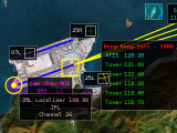
Navaids over VHHH - Hong Kong Intl

Navaids over VHHH - Hong Kong Intl

[an error occurred while processing this directive]